-
Best Hikes in San Francisco: Quick Guide
There is no place like San Francisco for hiking. Whether you are looking for the best view of the city, a quick walk full of military history, or an immersive all-day trek through coastal redwoods, San Francisco hiking trails will deliver.
Want to go bigger than a day hike inside city limits? Our guide to the best national parks near San Francisco covers eight parks within driving distance — from Point Reyes to Yosemite.
In this article, we have collected the 14 best hikes in San Francisco. We have organized the trails by whether they are best for nature, city views, or history. Within each section, the trails are roughly organized from easy and quick strolls to longer and tougher treks.
If you’ve already done these and want something bigger, check out our guide to national parks worth the drive — eight national parks within range of San Francisco, sorted by how far they are from the city.
We think this organization will best help you find the hike you are looking for, but we also encourage you to read through them all to find the best hike in San Francisco for you.
Insider’s Tip: If you would like to combine one of the best hikes in San Francisco with a visit to wine country, or a charming beach town, you need to check out these Muir Woods Tours.
And if you are on a tight schedule, but still want to see the best views mentioned in this article, including Twin Peaks and Sutro Baths, check out this Guided City Tour of San Francisco.
- Best Hikes in San Francisco for Nature Views
- Best Hikes in San Francisco for City Views
- Best Hikes in San Francisco for History
Best Hikes in San Francisco for Nature Views
Let’s begin with the best hikes in San Francisco for nature views. The following 6 San Francisco hiking trails will deliver stunning views of beaches, San Francisco Bay, Redwoods and more.
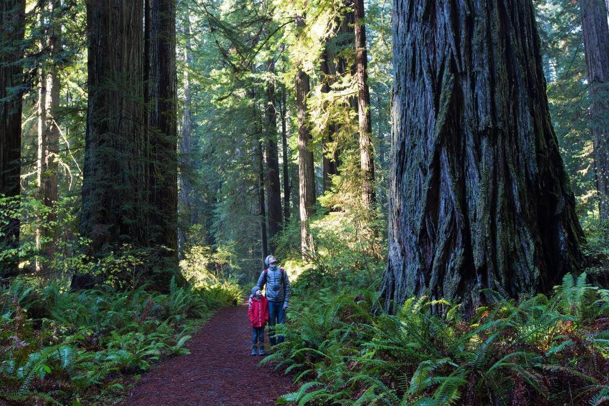
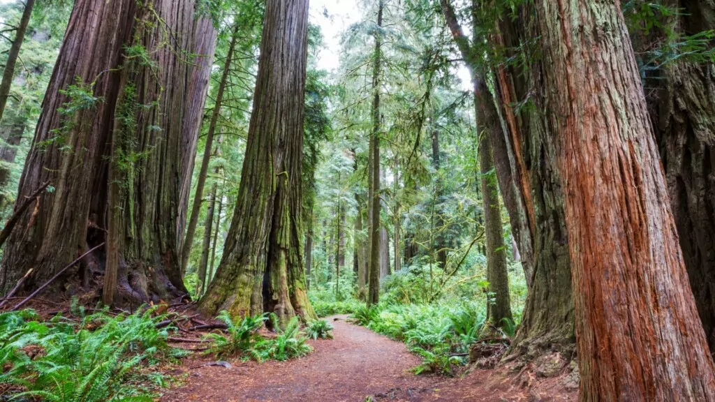
Redwood Creek Trail – Muir Woods National Monument
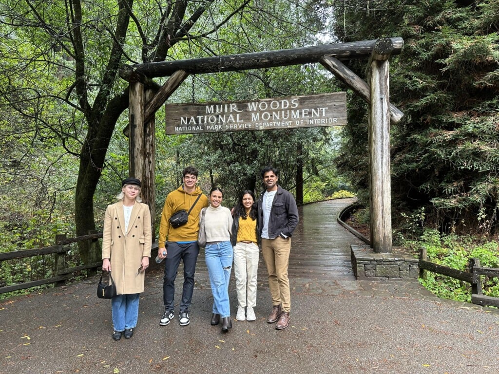
Muir Woods is on every list of the best hikes in San Francisco. With its towering old growth forest and accessible trails, Muir Woods easily offers some of the best hiking in San Francisco.
Most visitors start at the Visitor Center. From there you can follow the Main Trail through the old growth coastal redwoods to Bohemian Grove, Founder’s Grove, and Cathedral Grove.
There are 4 bridges across Redwood Creek. Take Bridge 2-4 to hike back and across Bridge 1 to the beginning. The further you go before you cross a bridge, the longer your loop will be. The loop using bridge 4 to the Hillside Trail/Bohemian Grove Trail is a 2-mile, 1.5-hour trip.
Length: 2 miles
Elevation Gain: 30 feet
Difficulty: Easy
Getting There: There are several ways to get to Muir Woods. Check out our article about the 5 best ways to Get to Muir Woods from San Francisco to find the best one for you.
Insider Tip: The easiest way to see the redwoods in Muir Woods and walk the Redwood Creek and Bohemian Grove Trails is to take a Muir Woods Tour. All of the annoying details like parking and reservations are taken care of by your driver, and you can just relax and enjoy the trees.

Exclusive Muir Woods, Napa & Sonoma Valley Wine Tour
The only wine country tour to combine three Napa & Sonoma Valley wineries with a morning excursion to San Francisco’s stunning Coast Redwood forest – Muir Woods.
Muir Woods Redwood Forest and Sausalito Morning Tour
This is the only Muir Woods tour with guided audio narration inside the park. Walk under the world’s tallest trees, then enjoy charming Sausalito.
Stow Lake and Strawberry Hill – Golden Gate Park
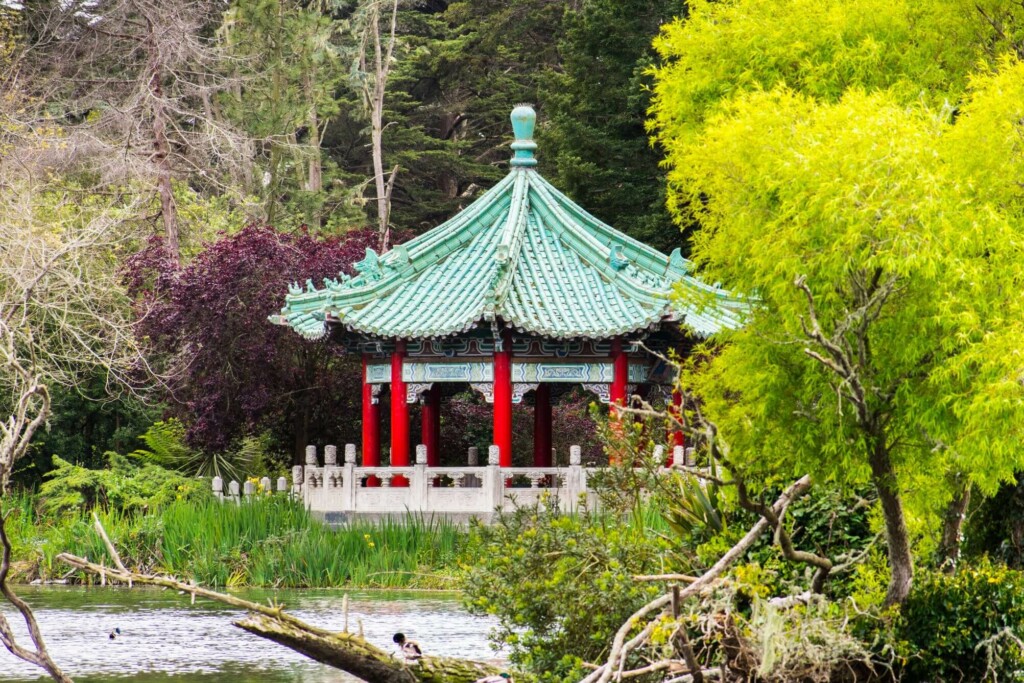
For a moment in nature in the middle of San Francisco, head to Golden Gate Park. Although manmade, Stow Lake and Strawberry Hill provide a remarkable bit of natural beauty, including a peaceful, wildlife-filled lake and a waterfall.
Begin anywhere along the Stow Lake loop. Take the leisurely trail around, looking for waterfowl, taking pictures at the chinese pavilion, or maybe even grabbing a snack at the Stow Boathouse. Then head across one of two bridges to Strawberry Hill. Make sure to take a minute to admire Huntington Falls on your way to the top for a view from the highest point in Golden Gate Park.
After your hike, maybe rent a boat for some time out on the water, or move on to one of the other fantastic things to do in Golden Gate Park.
Length: 2.1 miles
Elevation Gain: 170 feet
Difficulty: Easy
Getting There: Golden Gate Park is within reasonable walking distance from many places in the city, or you can hop on the MUNI 5 or 7 bus from downtown.
Insider Tip: Golden Gate Park is also a stop on the San Francisco Hop-on Hop-off bus tour. Many San Francisco visitors use this tour as a convenient way to travel from place to place in the city during their trip.
Mori Point Loop Trail – Pacifica
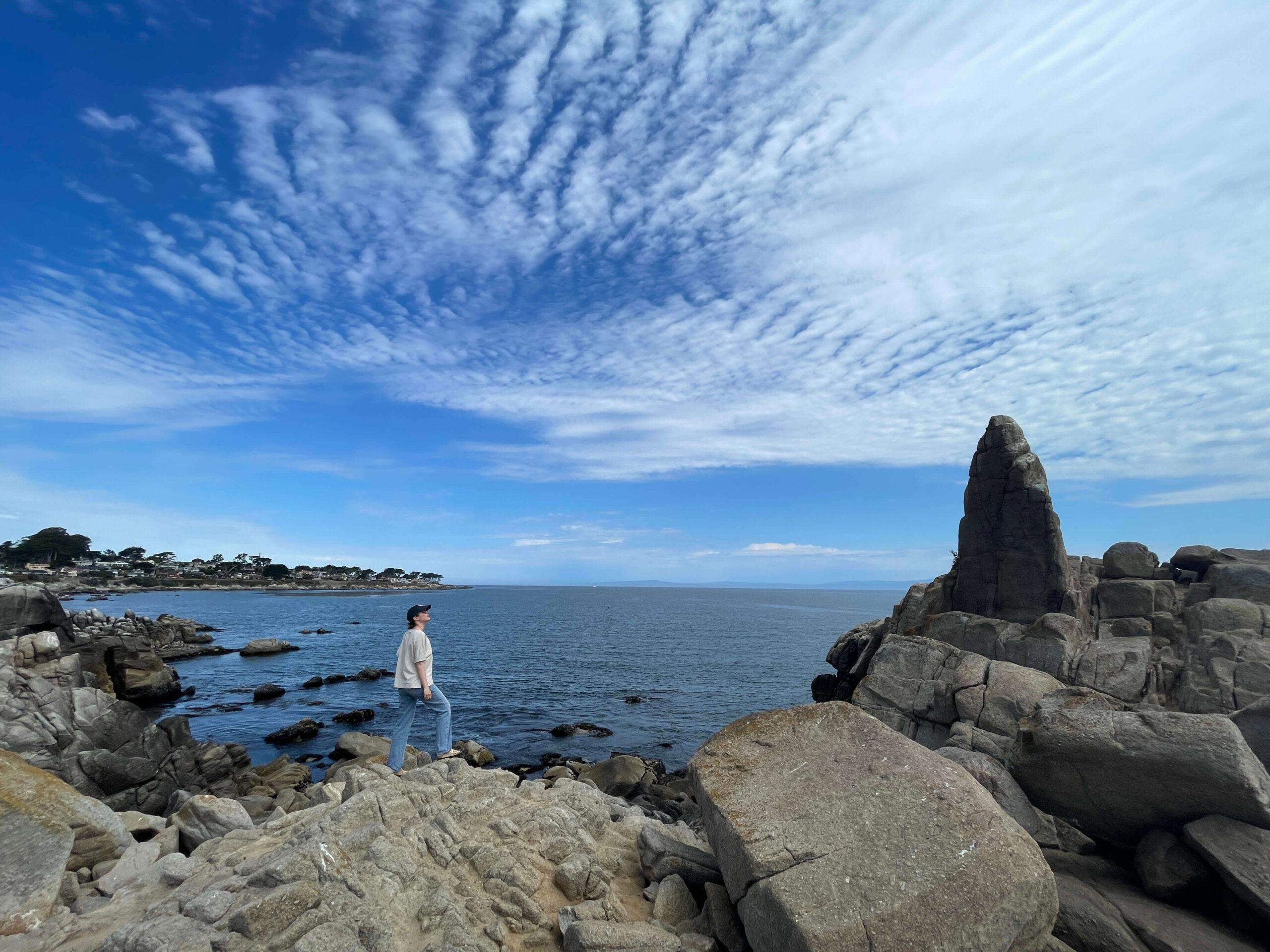
A little south of San Francisco lies the beaches of Pacifica and Mori Point. This new addition to the Golden Gate Recreation Area includes plunging coastal bluffs, wetlands, and beaches.
The Mori Point trail system includes everything from a 0.5-mile easy stroll to the moderately strenuous 1.5-mile coastal bluff trail. This area is fantastic for bird and whale watching, wildflowers in the spring, and to catch a peaceful sunset just out of the bustle of San Francisco.
Length: 1.5 miles
Elevation Gain: 400 feet
Difficulty: Moderate
Getting There: Pacifica is a 30-min drive South of San Francisco. There is a pretty simple way to reach Mori Point on public transportation with a combination of BART to Daly City and the 110 bus to Pacifica.
Fort Funston Trail
This San Francisco hiking trail is one for dog lovers. The Sunset Trail Loop in Fort Funston is a dog-friendly coastal trail just on the edge of the city. History lovers will love all of the crumbling remains of World War-era buildings and everyone else will love the quiet moment by the Pacific Ocean and all of the pooches to pet.
Length: 1.67 miles
Elevation Gain: 157 feet
Difficulty: Easy/Moderate
Getting There: Once again, this trail can be accessed on Public transportation via BART to Daly City and then bus, the 58 this time. If driving, the parking lot at Fort Funston is big and free.
Insider’s Tip: The bluff trails are paved, flat, and accessible. If you head down to the beach, be prepared for a difficult and steep trip.
Stream + French Trail Loop – Reinhardt Redwood Regional Park
If you are looking for a woodland hike near San Francisco, look no further than Reinhardt Redwood Regional Park in Oakland. It is a popular park, but the trail system is extensive, and you will get more time to yourself among the trees compared to Muir Woods.
The trade off is the coastal redwoods here are second and third growth and, therefore, much smaller. But the forest is still really nice, and you can come here time and time again and take a different trail. Reinhardt Redwood Regional Park is definitely worth exploring.
A great introduction to Reinhardt Park is a loop combining the Stream and French Trails into a 6.4-mile woodland hike, spending brief stretches on other trails to connect the two. Make sure you have a map of the trail system with you to keep on track.
Length: 6.4 miles
Elevation Gain: 1,200 feet
Difficulty: Moderate/Difficult
Getting There: While it is only a 20-minute drive from the city, getting to Reinhardt Redwood Regional Park on public transportation isn’t the easiest. We suggest taking an Uber if you don’t have your own car. Parking lots near the park are numerous and free except on some busy weekends and holidays.
Steep Ravine + Dipsea Trail – Mt. Tamalpais
Mount Tamalpais (Mt. Tam) stands tall in Marin County, nestled between Muir Woods National Monument and the Pacific Ocean. It provides miles and miles of fantastic trails, some that even connect to those within Muir Woods.
You can choose to summit Mt. Tam on more than one trail, with varying lengths and difficulties. The view from the summit is definitely not one you will forget in a hurry, but here we want to recommend another trail in the park. This one combines the Dipsea, Steep Ravine, and Matt Davis Trails into an unforgettable day hike that includes coastal redwood forest, rolling hills with Pacific vistas, seasonal waterfalls, and the gorgeous Stinson Beach.
Length: 6.7 miles
Elevation Gain: 1,700 feet
Difficulty: Moderate/Difficult
Getting There: There is a small fee for several of the parking areas in Mt. Tam State Park, including Pantoll, East Peak, and Bootjack. Public transportation is available from Sausalito on bus 61.
Best Hikes in San Francisco for City Views
Next let’s explore the best hikes in San Francisco for incredible views OF San Francisco. While you will probably choose these hikes for their city views, they also provide a refreshing dose of nature amidst the hustle and bustle. You may even see an endangered animal! Read on to find out where.
Filbert Steps to Coit Tower
This urban hike is a great way to burn off some lunch as you climb to one of the best views in the city. The series of steps will lead you past statues, manicured gardens, and great views of the Bay.
This hike is super convenient for San Francisco visitors, as it begins just three blocks from the Embarcadero up Sansome Street. From there, you will climb 400-500 steps to reach the base of Coit Tower. Thankfully, the sites along the way will distract you from the thigh burn!
Keep an eye out for art deco facades on the nearby buildings, historical placards, and the famous Telegraph hill parrots. These noisy residents have gained quite the fan base, and it is fun to see them enjoying nature’s bounty along the Filbert Steps.
Once you reach Coit Tower there is a $10 entry fee to reach the top. There you will find breathtaking views of the city, the San Francisco Bay, and the Golden Gate Bridge.
After climbing all of the Filbert Street Steps, you will be happy to learn there is an elevator to the top of Coit Tower. Although, if it is out of service, add another 13 flights onto your stair count.
Length: 0.5 miles
Elevation Gain: 262 feet
Difficulty: Moderate
Getting There: Walk from the Embarcadero. Street parking is also available nearby.
Insider Tip: To make this journey a loop, try coming back down the Greenwich steps. This will change up the views a bit and come out onto Sansome Street, just 1 block from where you began.
Twin Peaks
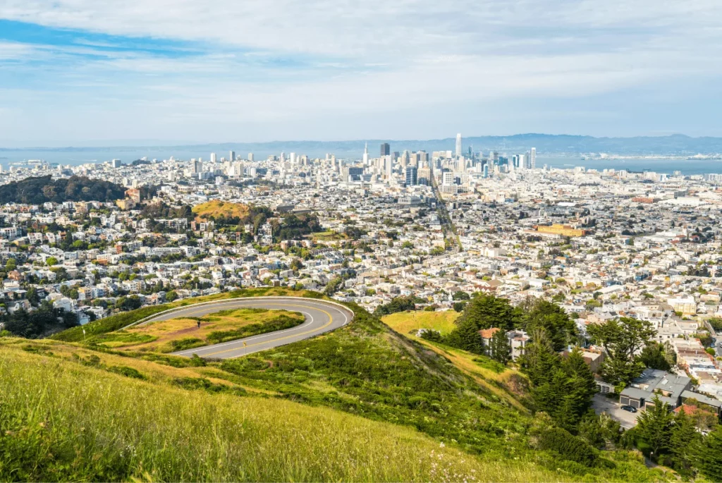
Head to Twin Peaks for a jaw-dropping panoramic view of the city. Yes, you can drive to one of the viewpoints on Twin Peaks, but we think the hike to the top is great in its own rite, and hiking up there tends to make the view even more amazing. Plus, the view from the South Peak is even better than from the North Peak Parking Lot.
The Twin Peaks summit stands at 922 feet, a close second for the highest point in San Francisco. That’s why the views from here are so awesome! There are no trees or buildings here to block your view of the entire Bay Area.
The trail up is a moderate climb through coastal scrub and grassland. It gives you a great idea of what this area looked like before it was developed. It is here that you may be lucky enough to see the endangered mission blue butterfly. They have adapted to the strong winds on Twin Peaks, and you may see them flying low from flower to flower.
Length: 0.7 miles
Elevation Gain: 400 feet
Difficulty: Moderate
Getting There: Take the MUNI 33 or 37 Corbett bus to the trailhead.
Insider Tip: Extend your hike by dipping into Glen Canyon Park. This is a beautiful and often overlooked area.
Mt. Davidson
Is there a San Francisco hiking trail to the city’s highest point? Yes there is! Mount Davidson takes the title from Twin Peaks by a mere 6 feet at 928 feet above sea level. The park offers a network of trails through eucalyptus forest and native scrub and grassland.
The trail to Mount Davidson is steep but short, with views along the way. On top you will find a 103-foot concrete cross, visible throughout the city. This cross was erected to commemorate the victims of the Armenian genocide.
The view from Mt. Davidson includes the Twin Peaks and a unique perspective down onto San Francisco’s iconic neighborhoods. While there are more trees at this viewpoint than Twin Peaks, the views are still fantastic, and the trail is less crowded.
Length: 1 mile
Elevation Gain: 242 feet
Difficulty: Moderate
Getting There: Take BART to Glen Park Station and then the MUNI 36 bus to Myra Way and Dalewood Way.
Best Hikes in San Francisco for History
It is extremely easy to find a history-focused hike in San Francisco that is also filled with breathtaking scenery. So all of the hikes in this section will reward you with both. That means that every kind of hiker in your group will love the hikes listed below! You’re welcome 😉
Battery Spencer Trail
Battery Spencer is a quick walk through a retired military battery to a spectacular viewpoint. The viewpoint at the end is quite crowded, but that is because it provides one of the best views of the Golden Gate Bridge that exists.
The viewpoint is awesome, but make sure you take plenty of time to explore in and around the old military site. Battery Spencer was once one of the main protection points for the San Francisco Bay. It was used through World War II when much of it was scrapped and reused. While there are no period guns remaining, history buffs will still enjoy the visit.
Length: 0.5 mile
Elevation Gain: 39 feet
Difficulty: Easy
Getting There: Battery Spencer is just North of The Golden Gate Bridge. It can be reached by taking the 130 bus toward Sausalito. This route does require an additional 0.8-mile walk just next to and under the highway in each direction though, so opting for a quick Uber may be the better option.
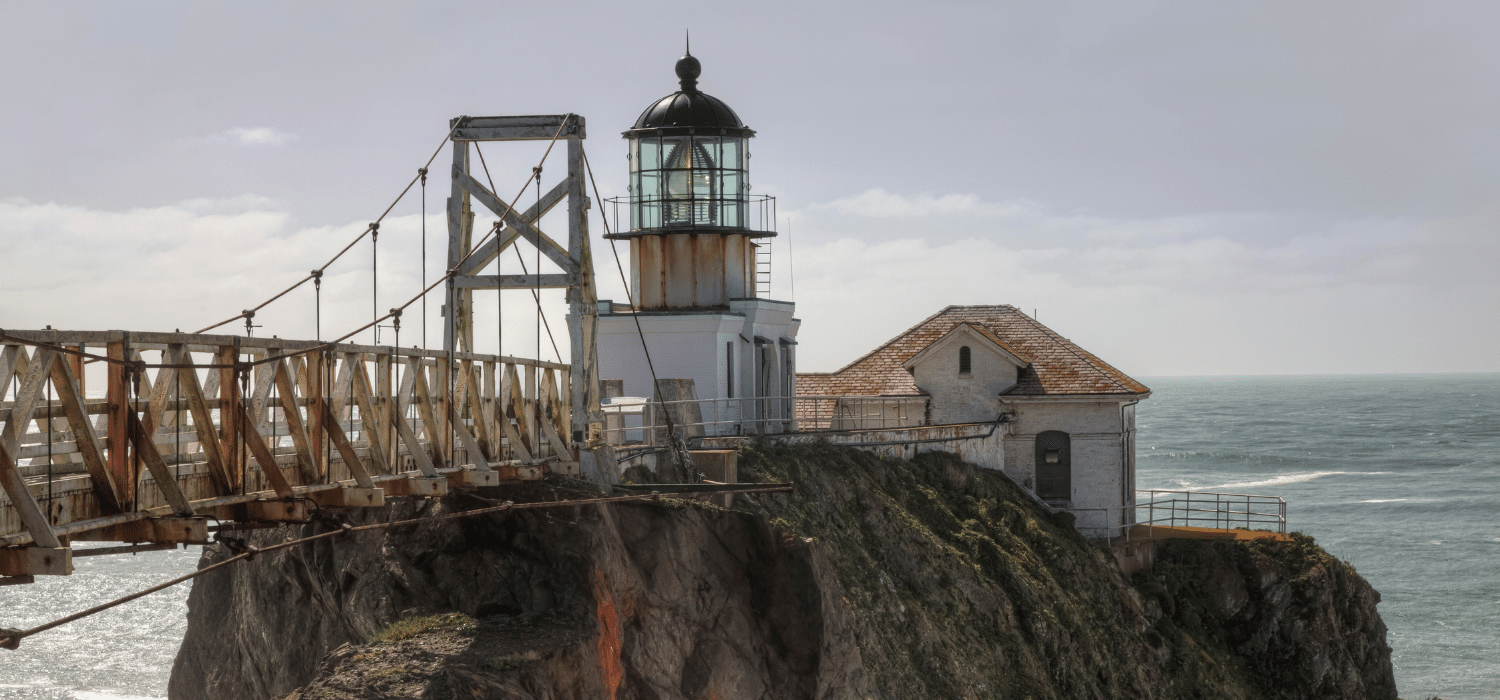
Point Bonita Lighthouse

Located in the Marin Headlands, the hike to Point Bonita Lighthouse combines rugged coastal views with a visit to the 3rd oldest lighthouse on the West Coast.
The trail out to Point Bonita Lighthouse is short but a bit on the rugged side. Once you make your way down, through the tunnel, and across the suspension bridge, you will arrive at the historic lighthouse.
The Point Bonita lighthouse was built to its current height in 1877, lowered from the original structure to better light the way through San Francisco’s famous fog. While you cannot climb the operational lighthouse, the downstairs has an interesting exhibit. Before heading back on the trail, enjoy the incredible views of the ocean and look for marine wildlife.
Length: 1 mile
Elevation Gain: 250 feet
Difficulty: Moderate
Getting There: The parking lot at Point Bonita is small. There is additional parking near the YMCA.
Insider Tip: While you can hike the trail anytime, the cave passageway and suspension bridge to the lighthouse are open on a very limited schedule. Check the NPS site for current hours before visiting.
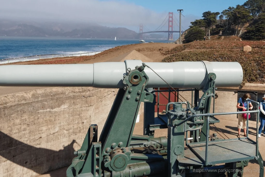
Batteries to Bluffs Trail
The Batteries to Bluffs trail, located in the Presidio, is one of the best short hikes in San Francisco. It does gain and lose significant elevation along its wooden stairs, but the vistas of the Pacific Ocean, Golden Gate Bridge, and historic batteries are well worth it.
The batteries in this area include Battery Crosby, Battery Godfrey, Battery Boutelle, and Battery Marcus Miller, several which were named after fallen soldiers. These concrete Endicott-era batteries were part of the coastal defense system of the U.S. between 1891-1946 and housed breech-loading cannons.
The Presidio has a network of trails in between viewpoints and batteries, making for a choose-your-own-adventure type of park. Exploration of all of the batteries, along with a trip down to the beautiful Marshall Beach to put your toes in the sand, may be longer than the basic 1.7-mile Batteries to Bluffs loop. So if you are a history buff and plan to see them all, plan for some extra steps.
Length: 1.7 miles
Elevation Gain: 500 feet
Difficulty: Moderate
Getting There: Take bus 28 to the Golden Gate Bridge Tunnel stop and walk 0.3 miles to the Langdon Court Parking Lot. Those driving can park in this lot or along the shoulder of Lincoln Boulevard.
Land’s End Trail
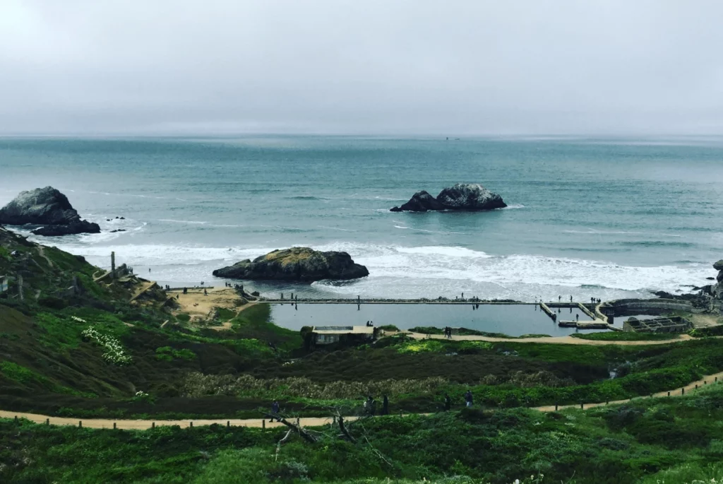
Lands End Trail might just be the number 1 must-do hike in San Francisco. Whether you are looking for history, views, or just a bit of exercise, this hike delivers.
Sites along this hike include the Sutro Baths, the remains of what was once a luxurious complex of ocean-filled swimming pools complete with slides, springboards, and trapezes. Another not-to-miss history stop along this trail is the USS San Francisco Memorial.
Look for sea lions perched on nearby rocks, and the quirky little Mile Rocks Lighthouse about 0.5 miles from shore. If you need a moment of relaxation, take a stroll through the Land’s End Labyrinth.
Length: 3.4 miles
Elevation Gain: 500 feet
Difficulty: Moderate
Getting There: The 38R Geary bus will take you within a quick walk of the parking lot where this trail begins.
North Ridge + Sunset Trails – Angel Island
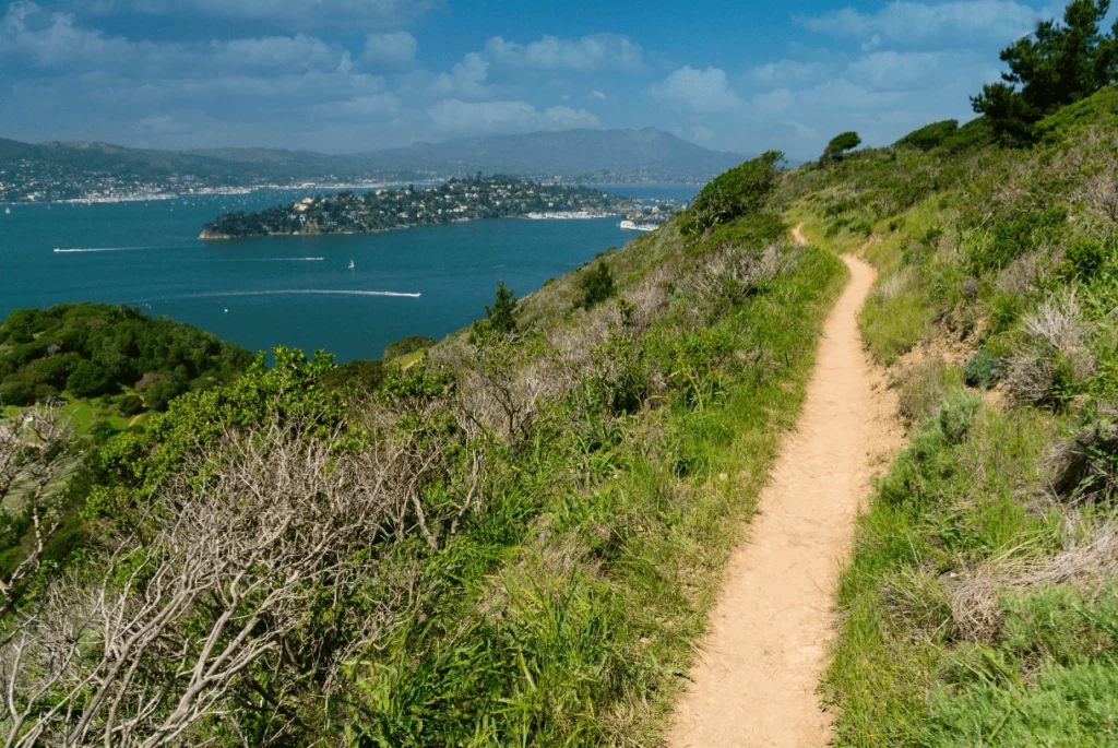
For an excellent triple threat (nature, city views, history) hike in San Francisco, hop a ferry to Angel Island. Angel Island is known as the “Ellis Island of the West,” and it is chock full of fascinating history and stunning natural landscapes. It has been everything from a Coastal Miwok hunting ground, to a supply stop for Spanish explorers, to a U.S. immigration station.
The 5.9-mile loop combining the Sunset and Nature Ridge Trails will show off everything the beautiful little island has to offer. The hike offers vistas of the surrounding Bay (including nearby Alcatraz Island), city views of San Francisco, up close encounters with the island’s unique ecosystem, and countless historically significant sites.
After your hike, check out the Barracks and Immigration museums, rent bikes, or grab a bite in the cafe. Keep in mind that services on Angel Island are dependent on the season, so make sure to check online before you go to see what is open.
Length: 5.1 miles
Elevation Gain: 780 feet
Difficulty: Moderate
Getting There: You need to take a ferry from either San Francisco or Tiburon to reach Angel Island. Luckily, the ferry is pretty inexpensive, includes the park entrance fee, and is a beautiful boat ride.
And there you have it friends — The 14 best hikes in San Francisco! We hope you will enjoy these San Francisco hiking trails for all of the city views, nature, and history they have to share.
And we hope these San Francisco hiking trails are just the beginning of your hiking exploration of Northern California. Expand your reach to one day trips from San Francisco, and you will discover a lifetime of adventure, from the rolling hills of Napa Valley to the granite slopes of Yosemite.
Remember: If you want an expert local guide to show you the best of San Francisco and beyond, including one day trips to Yosemite, check out all that Extranomical Tours has to offer!