Mission District, San Francisco
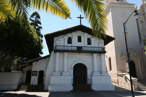
San Francisco‘s Mission District was named for the Mission San Francisco de Asis, a crude driftwood and tule reed harbor on the shore of the Lagoon of Our Lady of Sorrows. On June 27, 1776 Lieutenant-Colonel Juan Bautista de Anza, the leader of a small band of soldiers and immigrants from Spanish controlled Mexico, named the large lagoon “Laguna Nuestra Senora de los Dolores”. In today’s Mission District the site would be near the intersection of Camp and Albion streets just south of 16th street.
Featured tours
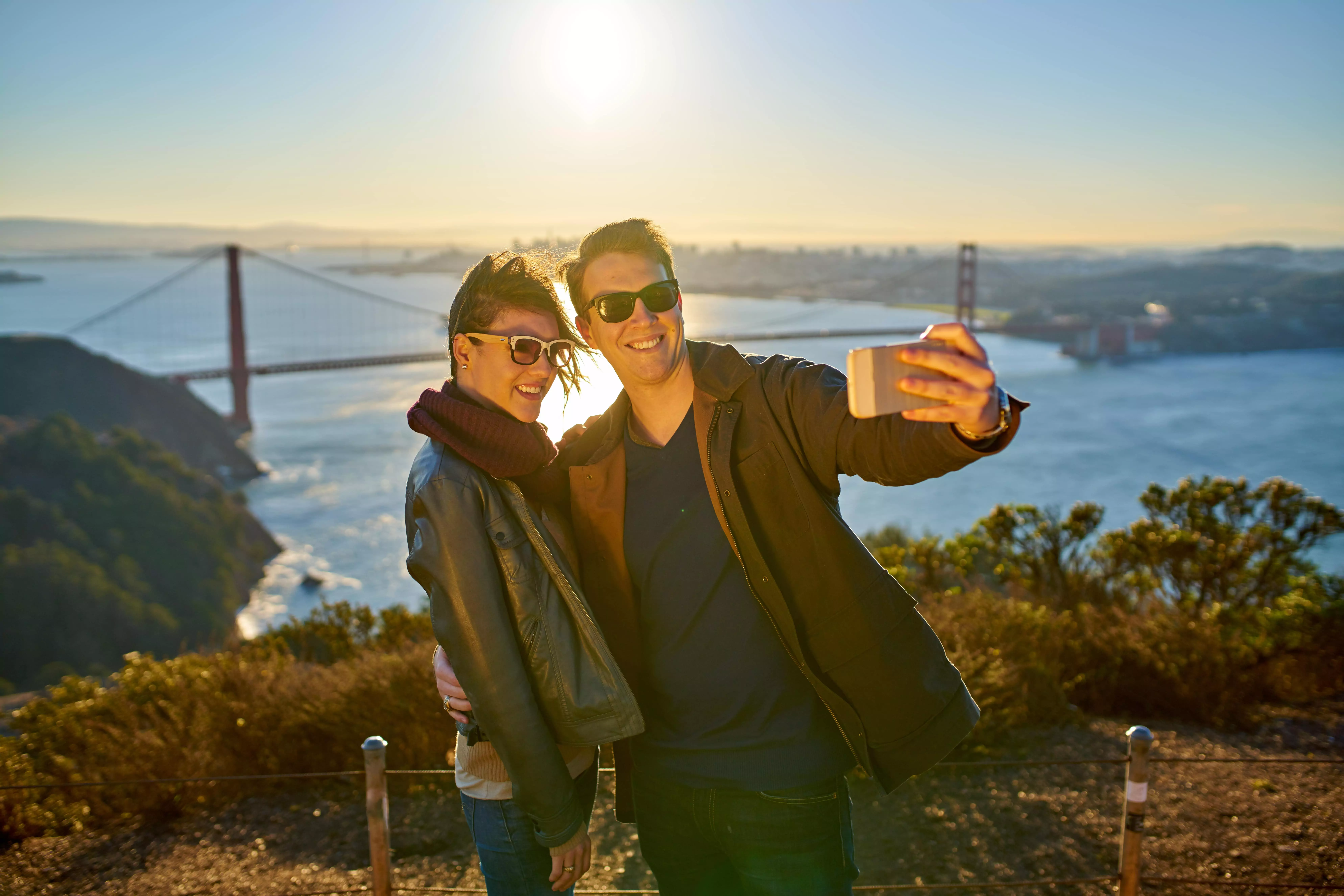
Morning Guided San Francisco Sightseeing Tour
Most complete and entertaining San Francisco city tour available. Stops to explore Golden Gate Bridge, Palace of Fine Arts, Land’s End, and Twin Peaks.
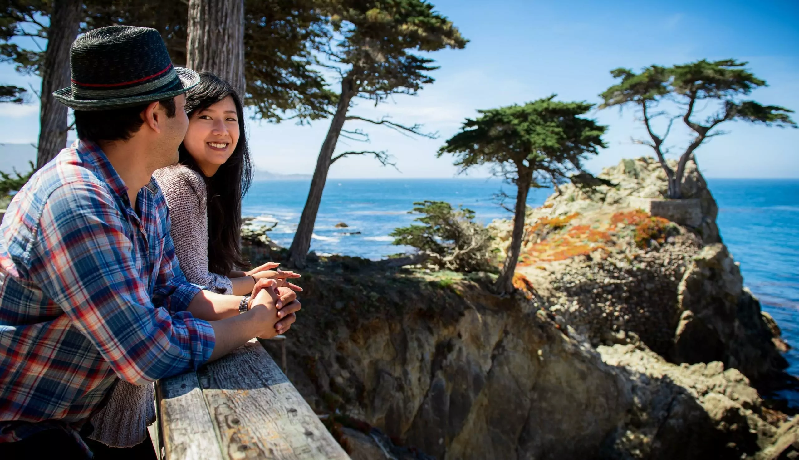
Monterey and Carmel One Day Tour from San Francisco
This day tour hugs the scenic Pacific Coast, then offers free time to explore the Monterey’s Cannery Row and Old Fisherman’s Wharf. Relax along the 17-mile Drive to Pebble Beach and charming Carmel.
Two days later on June 29, 1776 a Franciscan priest, Father Francisco Palou, consecrated the Mission San Francisco de Asis by offering a mass in the makeshift chapel. Although rebuilt in 1791 and now known as the Mission Dolores, San Francisco’s Mission District is the birthplace of The City by the Bay.
The original inhabitants of San Francisco’s Mission District were the Yelamu, a tribe of the larger hunter-gatherer society and language group known as the Ohlone that had lived peacefully for thousands of years in the paradise of coastal California.
The Yelamu were friendly toward the newcomers and greeted them with what modest gifts their apparent poverty would permit. But the purpose of the Franciscan padres at Mission Dolores and all the California Missions was to assimilate the native populations found in the Spanish territory of Alta or upper California and the rest of New Spain into the Spanish colonial culture. To this end the Franciscan priests, led by Father Junipero Serra, virtually enslaved the “Mission Indians” and tried unsuccessfully to force them to become civilized farmers and Christian neophytes.
These attempts at Christian conversion, the imposition of an alien European and agriculture based lifestyle, in addition to the effects of epidemic typhoid, smallpox and cholera on a population with no natural resistance drove the Ohlone peoples in general, the Yelamu in particular, to extinction. It has been estimated that the Ohlone lost ten percent of their pre-mission population.
In 1835 an estimated 2000 Ohlone remained yet the Mission San Francisco de Asis had expanded, now owning tens of thousands of cattle, sheep, and horses on pasture on Potrero Hill just east of San Francisco’s Mission District. Potrero is the Spanish word for pasture. And the Mission’s possessions included most of San Mateo County. By 1852 between 800 to 1,000 remained and by the 1880’s the Ohlone were essentially extinct.
Early immigrants from Mexico established a settlement, more of a camp really, in a cove about two miles from Mission San Francisco de Asis they called Yerba Buena, named after a rambling and aromatic herb the Spanish called “hierba buena” or “good herb” that formed an abundant ground cover around the cove. Today Yerba Buena is more familiar as Portsmouth Square and its shoreline is better known as Montgomery Street.
In 1821 Mexico won its independence from Spain and immigrants from Mexico began to taper off but in the early 1840’s, the Hudson Bay Company came to Yerba Buena and ships traveling around the horn of South America from the East Coast began to arrive with American immigrants in search of trade goods. In 1844 the isolated community had about a dozen houses and around 50 settlers. The camp began to acquire a reputation for tolerance and attracted nomads and deserting sailors.
In 1846, the US went to war with Mexico and on July 7, of that year Commodore John D Sloat sailed into Monterey and claimed California for the United States. Two days later, on July 9 the USS Portsmouth arrived at Yerba Buena. Captain John B Montgomery came ashore and hoisted the American flag on the Mexican flagpole in the small settlement’s plaza. Montgomery renamed the Plaza, at Yerba Buena, Portsmouth Square in honor of his ship.
In 1847 Washington Bartlett, the first American alcalde, or Mayor of Yerba Buena, renamed Yerba Buena “San Francisco” to match the name the Spanish mariner Sebastian Rodriguez Cerneno had given the bay in 1595.
In early 1848 the non-native population of San Francisco was said to be 575, males 177 females and 60 children. After the discovery of gold at Sutters mill in 1848, and the subsequent Gold Rush of 1849, the population of San Francisco was reported to exceed 100,000, comprised of at least 35,000 people who arrived by sea, 3000 sailors who deserted ships and 42,000 who came overland.
Two miles of sparse hills and sandy range with scattered patches of native grasses separated the Mission San Francisco de Asis from the center of the city. San Francisco’s Mission District remained fairly remote until a plank road made it easily accessible in 1850.
As late as 1855, “Mission Indians” would conduct bull and grizzly bear fights with a hind foot of the bear lashed to a forefoot of a bull.
Pioneer Race Course, built in 1864, was the first racetrack in what today is San Francisco’s Inner Mission District. It was bounded by what are now 24th and 26th Streets on the north and south, with Capp and Alabama Streets on the east and west.
In 1876, one could spend pleasant hours at Woodward’s Gardens located in San Francisco’s Mission District on the west side of Mission Street between 13th and 14th Streets. For an admission of 25 cents, you were entitled to visit a museum in the former residence of the proprietor Mrs. R. B. Woodward that displayed zoological specimens and precious stones. There were conservatories with exotic plants, an art gallery, an exhibit of rare coins, two large ponds complete with California Sea Lions and waterfowl in streams that coursed through the grounds. The Gardens claimed the largest aquarium in the country. On its second floor were large photographs of California scenery. A tunnel under 14th Street led to the zoological gardens with camels, deer, bison and an outdoor gymnasium. Within the main grounds of Woodward’s Garden was an outdoor auditorium large enough to seat six thousand patrons and a restaurant with indoor and outdoor seating.
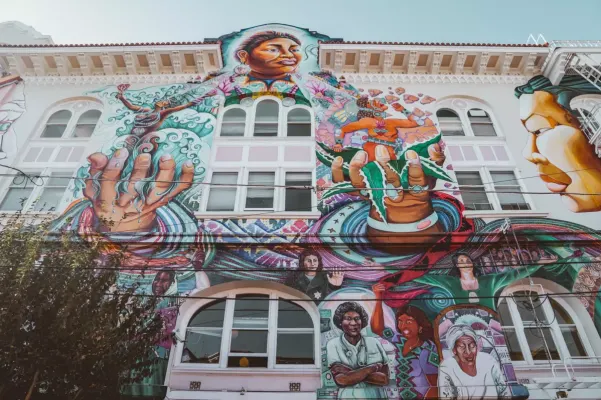
Irish and German immigrants made their home in San Francisco’s Mission District during the first half of the 20th century. Today large communities of Mexican and Central American immigrants call the Mission District home. San Francisco’s Mission District is replete with colorful indoor and outdoor murals of political and whimsical images, hundreds of restaurants ranging from taquerias serving inexpensive famous San Francisco Burritos to moderately priced haute cuisine.
San Francisco’s Mission District lies on the leeward side of Twin Peaks, sheltered from the fog that enshrouds the city in the late afternoon and early mornings during the summer months, providing sunshine throughout the day and clear, comfortable evenings.
The good weather promotes regular special events like Carnaval each May. Carnaval in San Francisco’s Mission District is modeled on Rio de Janeiro’s springtime Carnaval with samba dancing, beautiful costumes and raucous drumming.
November marks the annual Day of the Dead procession with thousands of costumed participants bearing candles and admiring hundreds of unique altars prepared to honor deceased ancestors and loved ones. The San Francisco Mime Troupe presents original musical comedies each summer, in the Mission District’s Dolores and Precita parks.
San Francisco’s Mission District offers music lovers endless varieties of buskers on corners. Mariachi bands often ride the bus, making the rounds of Mission Street restaurants on weekend nights. Even a New Orleans-style brass band can occasionally be seen marching on Valencia Street or in club venues. Rock, R&B, Blues, Bluegrass, Jazz, World Beat, African, and Salsa appear in numerous clubs throughout San Francisco’s Mission District almost any night of the week.
The San Francisco Mission District’s Community Music Center, located on Capp Street, offers professional training to young aspiring and virtuoso classical musicians. Samba schools and dance schools can be easily found. Poetry readings, bookstores, art galleries and thrift shops abound.